Hydro Leader: Please tell our readers about your background and how you came to be in your current position.
Nick Lesnikowski: I grew up in New England. I went to the University of Massachusetts and received a geology degree in 1982. Immediately after graduating, I accepted a job as a geophysicist with Amoco Production Company in New Orleans. Amoco liked to hire geologists and teach them geophysics as they practiced it. I worked in the offshore division, assessing lease holdings that were coming up for bid and things of that nature. I also did a bit of work with shallow hazard analysis and started to get familiar with side scan, high-resolution subbottom profiling, hydrography, and detailed mapping of areas where rigs might be placed.
I left Amoco after about 3 years and was commissioned as an officer in the National Oceanic and Atmospheric Administration (NOAA) Corps. I was assigned to the research vessel Discoverer, which was a class 1 vessel, meaning that it was one of the bigger ships that NOAA operated. I spent 2½ years on the Discoverer, going in and out of Seattle and all around the Pacific. It was a great experience.
I was lucky enough to be on the Discoverer when she became the second NOAA ship to be outfitted with a full-ocean-depth multibeam bathymetric system. It was a SeaBeam system that had 16 beams, which was a lot at the time. I was there during the installation and when everybody was getting up to speed on how it worked.
After my time in NOAA, I found a job in Seattle working for somebody who I met on the Discoverer, Mike Williamson. He’s a great guy and he had a great team of people with him. They were on the forefront of geophysics and deep-ocean mapping. I worked at Williamson & Associates for 14 years, doing all sorts of transoceanic and deep-ocean survey work. We developed a special kind of interferometric swath bathymetry that was highly innovative at the time.
As my family started growing, I needed to be closer to home in the Northwest, and it was the right time for me to change from worldwide to more regionally oriented work. I was lucky enough to meet Jon Dasler, and in 2001, I joined DEA. We do high-end, detailed bathymetric and geophysical surveys and a lot of support work for bridges, dams, and construction projects. I had a small hiatus of 5 years when I took a position at BlueView, which is an underwater sonar manufacturer. I assisted in the development, testing, and initial operation of some of its underwater 3‑D systems. Then, BlueView moved its operations back to Denmark, and after talking to Jon, I was able to step back over to DEA. I have been here a total of about 14 years. I handle a lot of the geophysical survey work, some profiling, seismic work, the underwater infrastructure mapping, and operations.
Hydro Leader: Please tell us about DEA as a company.
Nick Lesnikowski: It’s an absolutely wonderful company. It was founded around 1976 and had its roots in surveying and engineering and things of that nature. When I joined, I actually met David Evans and had a brief interview with him. Jon Dasler, who runs the marine services group, is a land surveyor, civil engineer, and hydrographer. He started DEA’s marine services division in 1989. DEA has grown over the years to a company of around 850 people. We’ve got about 29 offices, mostly on the West Coast, but also including offices in Colorado, Mississippi, Nevada, New York, South Carolina, Texas, and Utah.
Hydro Leader: Please tell us about your underwater dam inspections. Are those a part of normal scheduled dam inspections, or are they only needed in specific scenarios?
Nick Lesnikowski: Both. There are immense forces involved in dams: the power of the water being held back and the power of the water that’s rushing through. What that water can do to the physical structure needs to be monitored. We’ve been involved with different types of monitoring operations, some of which are critical—meaning there’s some risk that needs to be assessed—and some of which are routine annual or biannual surveys to inspect for any obvious damage to the structure and any infilling of sediments or debris that may obstruct intakes.
Hydro Leader: How are those inspections carried out?
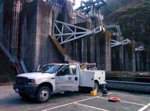
Nick Lesnikowski: We offer a wide variety of equipment, and there’s a range of things that fall under the term inspection. There are remote inspections that involve looking at the infilling of the bathymetry in the bottom of the sediment, and interactive inspections that involve close examination with a variety of sensors. We use high-precision positioning, so all our data are precisely geolocated. When we do a multibeam survey, we get a dense coverage of soundings of the structure and can see it in quite a lot of detail.
However, in some cases, there may be water flowing constantly and a lot of scour or undercut. In these scenarios, sometimes looking from the surface isn’t enough, and you have to get underneath the water, so we use ROVs or underwater tripods to inspect the structure from a different vantage point. Often, the water clarity is poor, so we put scanning sonar devices on the vehicles or tripods. There are different types of scanning sonars. One is an imaging sonar, which creates something like an acoustic photograph that allows you to see logs, debris, cables, cracks in concrete, and so on. We can also use a 3‑D scanning system, which collects both sounding and intensity data. We place it in a difficult-to-access area and then rotate the scanner 360 degrees to get a detailed point cloud. That’s especially useful for dams with an undercutting condition, because they are difficult to assess. The undercutting on footings won’t always be big and broad. If a diver goes down, it’s sometimes difficult to determine exactly where the diver got a probe measurement, and divers can only make a limited number of measurements. A scanner, by contrast, gets hundreds of thousands of data points, allowing us to see subtle undercuts, deeper undercuts, or narrow cracks that a diver might not be able to find or accurately quantify.
A lot of the time, we work with our clients to determine the best approach. We are also safety aware. We work closely with dam operators to keep safety paramount and make sure our operations are well thought through. We try to avoid putting people below a spillway or something similar if it can be avoided. In our work with the U.S. Army Corps of Engineers, we built a special deployment device that we lowered into a stilling basin, and we used an ROV equipped with video equipment and a 3‑D sonar system so that we could safely conduct a complete survey without the use of manned vessels.
Sometimes, we use remotely operated surface vessels, too. Other times, we have two vessels. The second vessel is unmanned but will track our primary survey vessel so that we can increase our coverage and our efficiency without having to increase the number of people involved in the project. That technology is becoming more and more prevalent, as are autonomous underwater vehicles and autonomous survey vessels.
Hydro Leader: Who are your clients?
Nick Lesnikowski: Our clients in the hydro industry include a wide range of commercial and governmental dam operators in the Northwest. A lot of times, we come in on specific operations. An organization will have a unique project that’s going to require detailed measurements so that structures can be assessed and anything that will need to be attached to the structure can be prebuilt. It is important that the measurements be precise so that whatever is built fits.
Hydro Leader: What are the most common issues your hydro clients are looking at?
Nick Lesnikowski: We see a lot of work assessing scour and undercut, including undercut inside training walls and sidewalls, undercut in structures, and the undercut of endsills. We also work extensively in upgrading structures. Sometimes, valves or other things that are highly integrated into the dam need to be replaced, which requires a large construction project. The dam itself will need to be assessed in its current condition to compare it with as-builts. We work with as-builts and information we collect from the client, but we have to go out and get current condition surveys so that the engineers have the best data. We also do a lot of work with fish bypasses. We are always trying to improve the functioning of fish transport systems.
Hydro Leader: Aside from these underwater inspections, are there any other services that DEA provides that our hydropower industry readers should know about?
Nick Lesnikowski: DEA has extensive experience in energy development, design, and project delivery. We support clients who provide renewable energy, including wind, solar, and wave power. We also provide consulting services that support traditional power delivery, including submarine transmission line route surveys and substation and transmission line design. We have a water and environment group that can assist with permitting. That team knows all the regulations and can walk clients through the whole process. Our roots are in surveying and geomatics, so we run a lot of land crews and do laser scanning. DEA has been doing laser scanning for more than 20 years. We have developed a lot of in-house techniques and have always kept our group at the forefront of emerging technology. We’ve integrated laser systems into our hydro vessels, so we can collect dense point clouds above the water as we’re collecting dense soundings below the water, providing a full view of a structure. We’ve been doing that on a lot of our big nautical charting contracts for NOAA. We just completed a large stretch of the lower Mississippi River, where we combined swath bathymetry and mobile LIDAR data into an integrated dataset, which included the heights of transmission lines over commercial shipping lanes.
Nick Lesnikowski is the senior geophysicist and underwater inspection manager for the marine services division at David Evans and Associates, Inc. He can be contacted at nsl@deainc.com or (206) 419‑4595. For more information on DEA’s marine services, visit deamarine.com.